

30 seconds summary
- Advanced seismic imaging is revolutionizing real estate development by providing a detailed understanding of subsurface conditions before construction begins.
- This technology allows developers to assess soil stability, detect underground utilities, predict groundwater movement, and identify environmental risks, all of which lead to more informed decision-making, reduced project costs, and enhanced safety.
- By uncovering hidden challenges and opportunities, seismic imaging optimizes resources, ensures regulatory compliance, and helps unlock new development sites, ultimately making construction projects more efficient, sustainable, and resilient.
In recent years, the field of real estate development has witnessed significant technological advancements, reshaping the way developers approach land acquisition, site planning, and construction. One such breakthrough is the integration of advanced seismic technologies into the real estate industry. Traditionally associated with oil and gas exploration, seismic imaging is now being harnessed to benefit developers by providing a comprehensive understanding of subsurface conditions before construction begins. This article explores how advanced seismic imaging is transforming real estate development, enabling developers to make more informed decisions, reduce risks, optimize resources, and enhance the overall quality of their projects.
What Is Advanced Seismic Imaging?
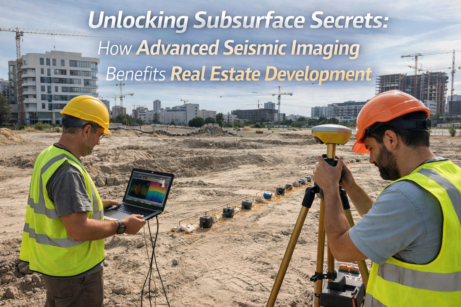
Seismic imaging, in its most basic form, is a technique that uses sound waves to map the subsurface of the Earth. By generating controlled seismic waves, sensors detect the waves as they travel through different layers of the Earth and reflect back to the surface. These waves provide critical data about the composition, structure, and stability of underground materials.
In real estate development, advanced seismic imaging refers to the use of more sophisticated techniques and equipment that allow for a more detailed and accurate understanding of the subsurface environment. These technologies employ a variety of methods, including but not limited to reflection seismology, refraction seismology, and borehole geophysics, to create highly detailed images of the ground beneath a development site. The resulting seismic data is then analyzed to produce 3D visualizations and other representations that help developers and engineers make informed decisions about how to proceed with a project.
The Role of Seismic Imaging in Real Estate Development
The construction of residential, commercial, and industrial properties requires careful planning and meticulous analysis of the land’s geological features. The challenges of building on sites with poor soil conditions, undetected underground voids, or unanticipated groundwater movement can lead to costly delays and structural issues. With advanced seismic technologies, real estate developers can unlock valuable subsurface secrets, offering several key benefits in the planning, construction, and long-term sustainability of a property.
Assessing Subsurface Geology and Stability
One of the primary benefits of seismic imaging in real estate development is its ability to assess subsurface geology and stability. Understanding the ground beneath a site is essential for determining the feasibility of construction and the safety of the buildings being planned. Soil conditions, bedrock quality, and the presence of faults or other geological hazards can significantly impact the design and construction process.
Advanced seismic imaging techniques allow developers to analyze the characteristics of the soil, the depth and type of bedrock, and any underground features like fractures, faults, or voids. This data can be crucial for determining the optimal foundation design, selecting appropriate building materials, and ensuring the structural integrity of the project.
For example, seismic imaging can detect the presence of soft or unstable soil layers, which may require the use of deep foundations or soil stabilization techniques to prevent settling or shifting. Similarly, if the site is located near an active fault line, seismic imaging can identify potential seismic risks, enabling developers to design buildings that meet seismic code requirements.
Identifying Underground Utilities and Infrastructure
Before breaking ground, developers must be aware of the location and condition of any existing underground utilities and infrastructure. These can include water pipes, gas lines, electrical cables, sewage systems, and telecommunications infrastructure. While utility maps and historical records can provide some guidance, they often lack the level of detail or accuracy needed to avoid costly mistakes during excavation.
Advanced seismic imaging offers a solution by providing real-time data about the location and depth of underground utilities. By using seismic waves to detect differences in material properties, seismic technologies can identify the presence of utilities that may not be reflected in traditional mapping sources. This allows developers to plan excavation routes more effectively, avoid accidental damage to utilities, and minimize project delays.
Moreover, seismic imaging can be used to assess the condition of existing underground infrastructure, such as aging pipelines or deteriorating foundations. This information is invaluable for determining whether any repairs or upgrades are needed before construction begins, reducing the risk of unexpected disruptions during the project.
Predicting Groundwater Movement and Drainage Issues
Groundwater movement is another critical factor that developers must account for when designing and constructing buildings. Water can seep into foundations, cause soil erosion, and create drainage problems that lead to structural instability and expensive repairs. Predicting groundwater movement accurately is challenging, as it often varies based on the local geology and climate conditions.
Advanced seismic technologies enable developers to assess the distribution of groundwater beneath a site by measuring how seismic waves travel through different materials. By analyzing the changes in wave velocities as they pass through water-saturated areas, seismic imaging can provide insights into the depth, flow patterns, and movement of groundwater. This allows developers to design effective drainage systems and foundations that prevent water-related issues.
Additionally, seismic imaging can help identify areas of high water saturation, which may indicate the presence of unstable ground or a risk of flooding. Early identification of these issues enables developers to mitigate potential risks and take preventative measures before construction begins.
Evaluating Environmental and Geotechnical Risks
Environmental and geotechnical risks are inherent in every real estate development project. For example, the site may be located in an area prone to landslides, flooding, or soil liquefaction during seismic events. Advanced seismic technologies provide a deeper understanding of the site’s geotechnical risks by mapping subsurface features such as soil compaction, bedrock depth, and the potential for ground movement.
Seismic imaging can detect zones of weakness or instability, such as areas where soil is prone to liquefaction during an earthquake or regions where landslides may be triggered by heavy rainfall. By identifying these risks early in the development process, developers can take proactive steps to reduce the likelihood of environmental disasters.
In addition, seismic imaging helps assess the potential impact of the development on the surrounding environment. For example, by monitoring ground vibrations and noise levels during construction, developers can ensure that their activities do not negatively impact nearby ecosystems or communities.
Enhancing Project Efficiency and Cost Savings
One of the most significant advantages of using advanced seismic technologies in real estate development is the ability to enhance project efficiency and reduce costs. Traditional methods of site evaluation, such as drilling and sampling, can be time-consuming, invasive, and expensive. Seismic imaging, on the other hand, provides a non-invasive and cost-effective way to gather high-quality subsurface data without the need for extensive drilling or excavation.
By obtaining accurate data early in the development process, developers can streamline their decision-making and avoid costly changes to the design or construction plan later on. Seismic imaging allows developers to identify potential issues, such as poor soil conditions or hidden utilities, before they become major obstacles, reducing the likelihood of unexpected delays and cost overruns.
Furthermore, advanced seismic technologies enable developers to optimize resource allocation. By gaining a better understanding of subsurface conditions, developers can choose the most appropriate construction techniques and materials for the site, ensuring that the project is completed on time and within budget.
Improving Safety and Regulatory Compliance
Safety is a top priority in real estate development, and advanced seismic imaging plays a crucial role in ensuring that construction sites meet safety standards. By identifying subsurface hazards and providing accurate information about the geological conditions, seismic imaging helps developers make safer design choices and build structures that are resilient to natural disasters, such as earthquakes and floods.
Seismic imaging also helps developers comply with regulatory requirements related to environmental impact and structural safety. In many regions, developers are required to conduct geotechnical surveys and submit reports detailing the subsurface conditions of their sites before receiving permits. By utilizing seismic imaging, developers can generate detailed reports that meet regulatory standards, ensuring that their projects are approved without delays.
Unlocking New Opportunities for Development
In many cases, advanced seismic technologies allow developers to explore new areas for development that would have been considered unsuitable or risky in the past. By gaining a better understanding of the subsurface environment, developers can uncover hidden opportunities for building on challenging sites, such as those with uneven terrain, rocky formations, or high seismic risk.
For instance, seismic imaging may reveal that a site previously thought to be unsuitable for development due to its proximity to a fault line is, in fact, stable enough to support construction. Similarly, seismic data may identify areas with high-quality soil or favorable groundwater conditions, making them ideal for large-scale residential or commercial developments.
By unlocking these subsurface secrets, seismic imaging broadens the range of possible development projects, opening up new opportunities in urban and rural areas alike.
Conclusion
The integration of advanced seismic technologies into the real estate development process is revolutionizing the way developers approach site evaluation, planning, and construction. By providing a detailed and accurate understanding of the subsurface environment, seismic imaging helps developers make informed decisions, reduce risks, optimize resources, and ensure the long-term success of their projects. From assessing soil conditions and identifying underground utilities to predicting groundwater movement and mitigating geotechnical risks, the benefits of seismic imaging are clear. As the real estate industry continues to evolve, advanced seismic technologies will play an increasingly important role in shaping the future of urban development, making it safer, more sustainable, and more efficient for all involved.


